- Read offline
- Access all content
- Use the in-app Map to find sites, and add custom locations (your hotel...)
- Build a list of your own favourites
- Search the contents with full-text search functionality
- ... and more!
Ikaría
The island of longevity

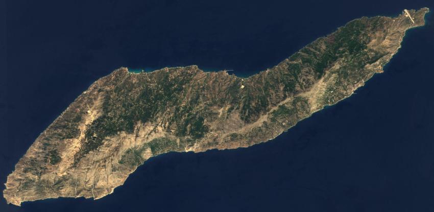
A giant sea cucumber on the map, 40km long and only 5 to 9km wide, Ikaría presents a forbidding, rocky face to the world. It is one of the most mountainous islands in Greece, divided neatly in two by the dorsal range of Atheras, with peaks over 1,000m often lost in billowing cloud.
Yet both the wooded north coast (with a monopoly on the sandy beaches) and more rugged south coast (with pebbly beaches and rocks) are watered by mountain springs that keep them green under oak, pine and plane trees, with added natural air-conditioning from the wind.
The Ikarian Sea is one of the wildest corners of the Aegean; if it’s calm on one side of the island it’s more likely than not blustery on the other, whipping up rainbows of sea mist. Forget the myth: it was the wind that brought Ikaros down here, not the sun.
Don’t come here if you’re in a hurry or want to see big sights; life here is at such a slow pace that the locals joke about living in their own Ikarian time zone. Development, too, has been slow here, partly for political reasons, partly by choice, and nearly all is in the traditional style; in recent years Ikaría has been held up as a model microcosm of environmental and economic sustainability. Increasingly people come here for the hiking.
Images by adamansel52, Aegean1, ArishG, Dana Facaros, George Tsiagalakis, Jakefive82, Leeturtle, Creative Commons, Man77, Rosa-Maria Rinkl, Sentinel-2 cloudless 2016 by EOX ITCC, Zacharias Mitzelos, Zouzouloo

