- Read offline
- Access all content
- Use the in-app Map to find sites, and add custom locations (your hotel...)
- Build a list of your own favourites
- Search the contents with full-text search functionality
- ... and more!

Elafónisos
Soft pink sands and an ancient city
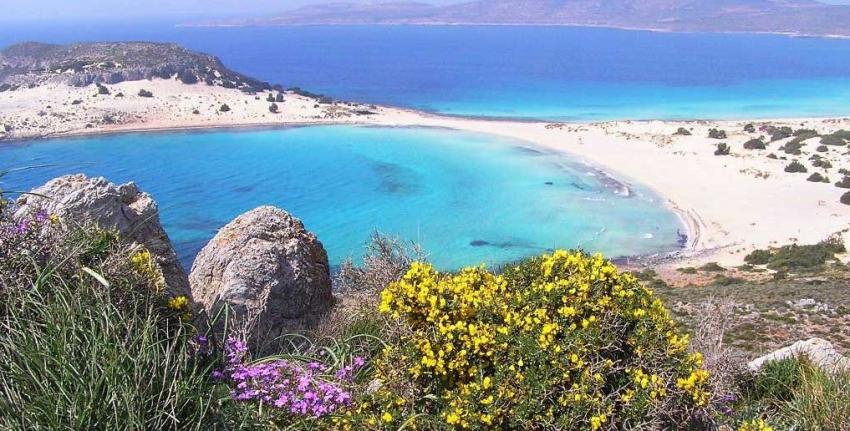
Although long a best kept secret, recently improved air connections with nearby Kythera have seen little Elafónissos hit the travel magazines, with sumptuous pictures of Fragó Bay, endowed with two of Greece’s most gorgeous beaches of powder soft sand, Símos and Sarakíniko, kissed by the clearest of Caribbean green-blue waters.
Elafónisos is becoming a victim of its success, however: too many people (mostly Greek holiday makers) jam on it in August, making the very short ferry hop (you could swim there, really) over just for a day at the beach, when the island deserves visitors who linger for a few days or weeks, to relax, to forget the rest of the world at least for a while.
In 2013, a group of citizens who love the island founded Elafonisos Eco to help it go forward in a sustainable matter, taking ideas from other small ‘eco islands’ such as Astypálaia and Tílos to preserve its natural beauty, plant trees, build water kiosks (to keep people from buying yet more plastic bottles), to clean up the plastic in the sea and encourage bicycle use, etc; Prince Albert of Monaco has taken an interest.
Elafónissos is one of Greece’s newer islets – until an earthquake in the 5th century AD, it was attached to the Peloponnese. But even if it’s only 570m (626 yds) from shore, Elafónissos was island enough to be part of the Ionians and ruled by Venice and Britain instead of the Ottomans. In ancient times it had a Temple of Artemis, which may be why its name means ‘deer island’ (similar to another islet of gorgeous beaches in Western Crete).
Besides its superb beaches, Elafónissos is famous for the world’s oldest sunken city, dating back to at least 2800 BC and the Late Neolithic period; several large Minoan jars proved it had close contacts with Crete. Named Pavlopétri after the nearby islet, it was discovered by Nic Flemming in 1967 and explored and mapped the following year by a team from the University of Cambridge.

Pavlopétri existed, they believe, for nearly 2000 years before subsided into the sea thanks to rising sea levels and an earthquake in c1000 BC. Its buildings, temple, streets and water system are so well preserved and that in 2009, when researchers explored Pavolpétri using the latest technology (subject of a BBC2 documentary, The city beneath the waves: Pavlopetri) they were able to reconstruct its appearance. In 2016, it was listed on Unesco’s World Monuments Watch.

Elafónisos’s 800 current inhabitants live in the island’s one town, with its landmark, red-roofed church of Ag. Spyridon (1862) on a small island at the entrance to the port. Most are fishermen, but in August they are crushed under a thundering invasion when as many as 5,000 people and 1,500 cars make the crossing each day.
Besides the famous beaches, you’ll also find a good sandy stretch on Elafónisos’s west coast by Ta Nisiá tis Panagías, the ‘Virgin’s Islands’.

Ferries depart several times a day in winter, and nearly every half hour from Poúnta just north, and take 8 minutes.
Images by Arys, Georgios Kapsas, PD art